
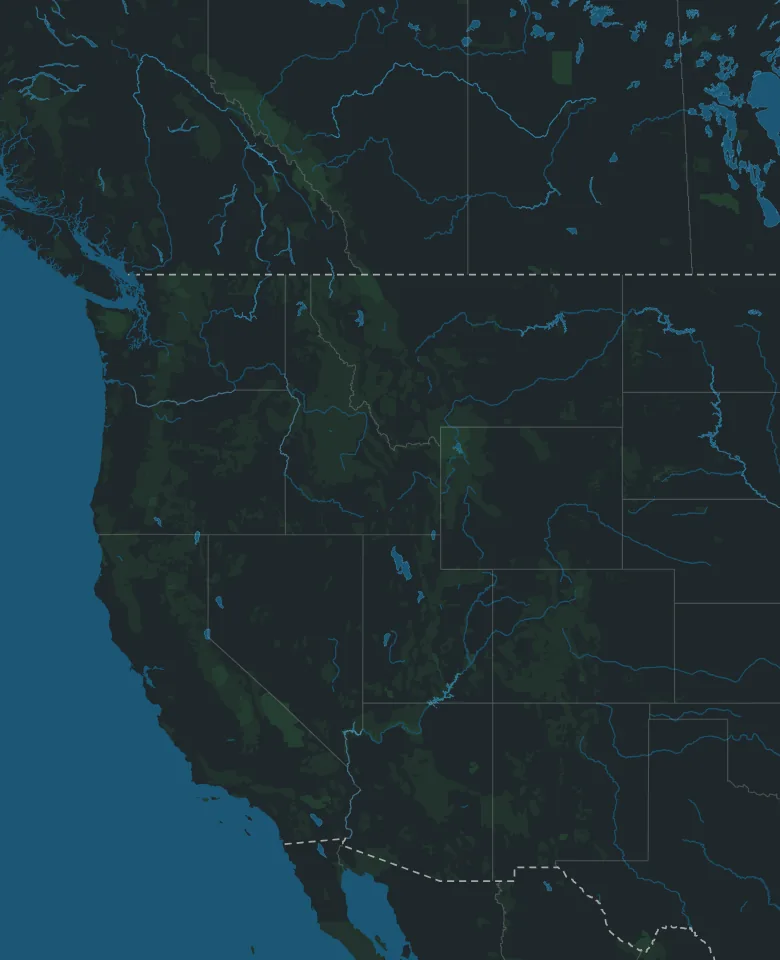
Map: © OpenStreetMap contributors, Overture Maps Foundation
Road trip from Canada · Montana to Arizona
Calgary to Phoenix
By Thimble Travel · Last checked November 2026
A road trip from Calgary to Phoenix, planned from the Canadian side: the border, health coverage, staying 30 days or more, and the drive day by day, by way of Zion and Hoover Dam.
Map: © OpenStreetMap contributors, Overture Maps Foundation
Getting there from Canada
What changes when the trip starts on this side of the border.
The border
Coutts, Alberta, into Sweetgrass, Montana, on Interstate 15, is open 24 hours a day. US officers may ask for your address in the US, proof of your home, job or school in Canada, and proof that you can pay for your stay.
What to bring
Canadian citizens 16 and older need a valid passport or a trusted traveller card, such as NEXUS. Children 15 and under can use a passport, a birth certificate or a Canadian citizenship certificate.
Your Canadian driver's licence is good in the US. Carry proof of your car insurance too.
Staying 30 days or more
If you'll be in the US 30 days or longer, everyone 14 or older must be registered with the US government before the 30 days are up, and parents must register children under 14. It applies to every trip that long.
Crossing by car, you may not have been registered at the border. Check, and see how to register, on the US government's registration page.
Health coverage
Alberta's health care plan pays only part of emergency doctor and hospital bills outside Canada. You pay the bill there, then claim back what Alberta allows, and it doesn't pay for ambulances. Alberta strongly recommends travel medical insurance.
Away for the winter? Your coverage carries on outside Canada for less than 6 months in a row. If you go away every year, for up to 212 days in 12 months, you may keep it too: contact Alberta's health care plan before you leave and when you're back.
Zion's park pass
Every car that enters Zion needs a park pass, even just to drive through. It lasts 7 days: buy it online before you go, or at the entrance. No reservation is needed, for the park or its shuttle. Visitors 16 and older who don't live in the US also each pay a nonresident fee, unless someone in the car has an annual pass, which covers them and everyone riding with them.
The amounts are on the park's fees page.
The time
Phoenix is an hour behind Calgary all year, since neither Alberta nor Arizona changes its clocks. On the way, Montana, Idaho and Utah are an hour behind Calgary from early November to mid-March, and on Calgary's time the rest of the year.
Nevada, and Hoover Dam's hours, are an hour behind Utah all year.
The trip, day by day
Four days' drive each way, with Zion and Hoover Dam on the way down, and two days in Phoenix. Drive times are for driving only, without traffic or stops.
Day 1 · Calgary to Butte
About 755 km, about 7 hours of driving
Morning
South to the border
Through Lethbridge, then Highway 4 to Coutts. About 320 km, about 3¼ hours.
The crossing is open 24 hours a day. From early November to mid-March, the clock goes back an hour as you cross.
Afternoon
Interstate 15 to Butte
Through Great Falls and Helena to Butte. About 435 km, about 3¾ hours more.
Day 2 · Butte to Salt Lake City
About 670 km, about 5¾ hours of driving
Morning
Over Monida Pass into Idaho
South on Interstate 15 over Monida Pass, about 2,080 metres up, then down through Idaho Falls and Pocatello.
In winter, check Montana's 511 and Idaho 511 for the pass before you leave Butte.
Afternoon
On to Salt Lake City
Into Utah, then through Ogden to Salt Lake City.
Day 3 · Salt Lake City to St. George, by way of Zion
About 575 km, about 5½ hours of driving
Morning
South to Zion
Interstate 15 south, then east through Springdale, the town at the park's entrance, to the Zion Canyon Visitor Center. About 500 km, about 4½ hours.
The visitor center's lot is the park's largest, and free once you have your pass, but it often fills early in the day.
Afternoon
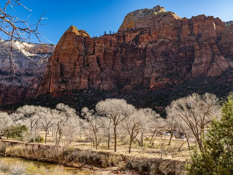
Up Zion Canyon
The free shuttle runs from the visitor center up Zion Canyon to the Temple of Sinawava, about 45 minutes each way, stopping at the trailheads on the way. Get on and off at any stop that's open.
In most years, shuttles run daily from March through November and over the holidays at the end of December, and then cars can't use the canyon road. The rest of the winter, you can drive it yourself.
Late afternoon
On to St. George
Back through Springdale to Interstate 15, then south to St. George. About 75 km, about 1 hour.
Day 4 · St. George to Phoenix, by way of Hoover Dam
About 655 km, about 7 hours of driving
Morning
To Hoover Dam
Interstate 15 to Las Vegas, then south past Boulder City to the dam, on the Nevada and Arizona line. About 240 km, about 2½ hours.
The clock goes back an hour on the way.
Midday
Hoover Dam
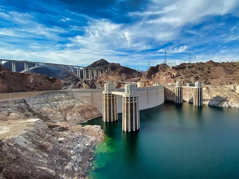
Leave the car in the garage on the Nevada side, by the visitor center, and walk out on top of the dam, about 220 metres high, with Lake Mead on one side and the canyon far below on the other. The visitor center has exhibits, an observation deck and tours.
Every vehicle can be inspected at the security checkpoint on the road in. The dam is open 5 am to 9 pm, and the visitor center 9 am to 5 pm except Thanksgiving and Christmas Day, on Nevada's time.
Afternoon
On to Phoenix
Back out the way you came in, then over the bridge into Arizona and down US 93 through Kingman to Wickenburg, and on to Phoenix. About 415 km, about 4½ hours.
From early November to mid-March, the clock goes forward an hour at the bridge.
Day 5 · Papago Park
Morning
Hole-in-the-Rock
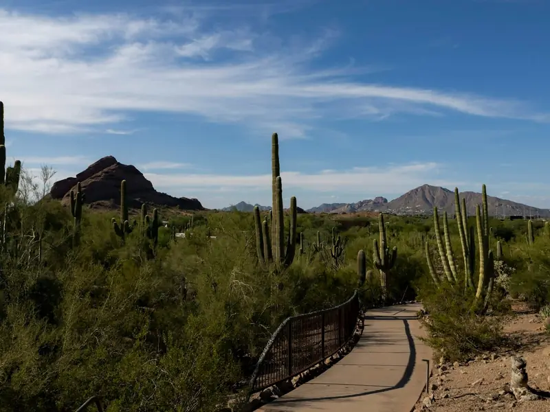
In Papago Park, minutes from downtown, a short trail of about 300 metres wraps around a red sandstone butte to a large hole worn through it by the wind, looking out over the city. There are steps on the far side.
Start at the Papago Park Visitor Center. The trailhead is open 5 am to 7 pm.
Afternoon
The Desert Botanical Garden
Also in Papago Park, the garden's paths wind through a collection of 55,000 plants, among them the world's largest collections of cactuses and agaves.
Until February 26, it's open 7 am to 10 pm on most days. Parking is free.
Day 6 · South Mountain and the Heard Museum
Morning
South Mountain
One of the largest city parks in the US, with more than 160 km of trails. Drive Summit Road, or hike up, to Dobbins Lookout, the park's highest point open to the public, for a view over the whole valley.
Its entrance and parking are open 5 am to 7 pm. On Sundays, cars can't drive up Summit Road until 10 am, and on the fourth Sunday of the month the road into the park is closed to cars all day.
Afternoon
The Heard Museum
On Central Avenue in downtown Phoenix, the Heard shows the art and tells the stories of American Indian artists, from historic pieces to work made today.
Open 10 am to 4 pm every day except a few holidays, and Mondays from June to August, with free tours at 10:30 am, noon, 1 pm and 2:30 pm. Parking is free.
Days 7 to 10 · Home the same way
About 2,555 km, about 23¾ hours of driving
Day 7
Phoenix to St. George
Back past Hoover Dam and Las Vegas, and up Interstate 15. About 645 km, about 6¾ hours.
Day 8
St. George to Salt Lake City
Up Interstate 15. About 485 km, about 4¼ hours.
Zion's Kolob Canyons, with its own visitor center and a scenic drive, is right off Interstate 15 at exit 40. A park pass lasts 7 days, so the one from Day 3 still covers it.
Day 9
Salt Lake City to Butte
Back over Monida Pass. About 670 km, about 5¾ hours.
Day 10
Butte to Calgary
About 755 km, about 7 hours.
From early November to mid-March, the clock goes forward an hour at the border.
Good to know
- Speed limits in the US are in miles per hour: 80 on most of Interstate 15 from Montana to southern Utah, 75 on most of it south of St. George, and 65 on most of US 93 in Arizona.
- Don't take cannabis across the border, in any amount, even into a state where it's legal.
- Some medicines sold without a prescription in Canada need one in the US. Bring enough of yours for the whole trip, and a note from your doctor if you have a medical condition.
- Coming home, declare what you bought. How much you can bring back without paying duty or taxes depends on how long you were away.
- In winter, check 511 Alberta, Montana's 511 and Idaho 511 before you go, and leave extra time.
- Hours and dates on this page were checked in November 2026. They can change, so check the official websites before you go.
Going with family or friends?
Send this page to the group chat, so everyone has the drive on one map.
Plan your Phoenix trip
Tell Thimble and it'll build a full itinerary for you.

Scan with your phone to get the app.
Phoenix, Arizona
Map: © OpenStreetMap contributors, Overture Maps Foundation
Checked in November 2026 on the websites of the Government of Canada (travel advice for the United States), the Canada Border Services Agency, US Customs and Border Protection, US Citizenship and Immigration Services, the Government of Alberta, the Montana Department of Transportation, Idaho 511, the US National Institute of Standards and Technology, Zion National Park, the National Park Service, the Bureau of Reclamation, the City of Phoenix, the Desert Botanical Garden, the Heard Museum and Visit Phoenix. Distances and speed limits are from OpenStreetMap. Drive times are worked out from them, without traffic or stops.