
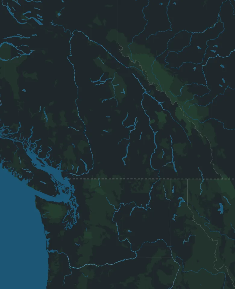
Map: © OpenStreetMap contributors, Overture Maps Foundation
Road trip from Calgary · British Columbia
Calgary to Tofino
By Thimble Travel · Last checked November 2026
A road trip from Calgary to Tofino, over Rogers Pass and the Coquihalla and across to Vancouver Island by ferry: park passes, winter tires, the ferry, the time change, and the trip day by day, with two days on the coast.
Map: © OpenStreetMap contributors, Overture Maps Foundation
Before you drive
What to know before you leave Calgary.
The mountain parks
The highway runs through four national parks: Banff, Yoho, Glacier and Mount Revelstoke. Driving straight through needs no pass. Stop anywhere in them, even at a viewpoint, a picnic site or the town of Banff, and you need one. One daily pass covers all four, until 4 pm the day after you buy it. Buy it online, or at the park gate on the highway.
Driving west without stopping? Use the through lane on the far right at the Banff East Gate.
Winter tires
From October 1 to April 30, BC requires winter tires on most of its highways, Rogers Pass included. A winter tire shows M+S or the mountain and snowflake, and has at least 3.5 mm of tread. Summer tires aren't allowed, even with chains.
Parks Canada and BC recommend the mountain and snowflake. Signs mark where winter tires are needed, and on a few lower highways the season ends March 31.
Rogers Pass in winter
The highway climbs to 1,330 metres at Rogers Pass, past 135 avalanche paths in 40 km. It closes at times for avalanche control, for 2 to 8 hours or longer, and for long closures traffic is held in Golden and Revelstoke. Don't stop where signs say no stopping.
Before you leave, check DriveBC, which shows closures, planned ones too. Keep the tank full, and carry water, food, warm clothes and blankets.
The time
Tofino is an hour behind Calgary, all year. Golden keeps Alberta's time, so the clock goes back an hour between Golden and Revelstoke, and forward an hour on the way home.
The ferry
The drive crosses to Vancouver Island with BC Ferries, from Tsawwassen, south of Vancouver, to Duke Point, in south Nanaimo. The crossing takes 2 hours. Book a sailing ahead, or drive up and go in the order you arrive.
With a booking, check in 30 to 60 minutes before the sailing, or the booking isn't kept. See the sailings and book on BC Ferries.
Pacific Rim's pass
The beaches and trails between Tofino and Ucluelet are in Pacific Rim National Park Reserve, which needs a pass of its own, on your dashboard whenever you stop there. A daily pass lasts until 4 pm the day after you buy it, and a 4 hour pass covers Long Beach, Wickaninnish Beach and the Kwisitis Visitor Centre. A yearly Discovery Pass covers this park and the mountain parks too.
Buy it at the machines in the park's parking lots, which take credit cards only, or at the visitor centres in Tofino and Ucluelet. Anyone 17 or under gets in free.
The trip, day by day
Three days' drive each way, with the ferry on the second, and two days on the coast. Drive times are for driving only, without traffic, stops or the ferry.
Day 1 · Calgary to Kamloops
About 620 km, about 7 hours of driving
Morning
Through Banff and Yoho to Golden
West on the Trans-Canada Highway through Banff and Yoho national parks to Golden. About 260 km, about 3 hours.
Stretch your legs on Golden's pedestrian bridge over the Kicking Horse River, at 8th Avenue North. At 46 metres, it's the longest freestanding timber frame bridge in Canada.
Afternoon
Over Rogers Pass to Kamloops
Fill up in Golden first: there's no gas at Rogers Pass. Then over the pass, through Revelstoke and on to Kamloops. About 360 km, about 4 hours.
The Revelstoke Railway Museum, at 719 Track Street West, is open Thursday to Sunday.
Day 2 · Kamloops to Nanaimo
About 375 km, about 4 hours of driving, and 2 hours on the ferry
Morning
Down the Coquihalla to Hope
South on the Coquihalla Highway, through Merritt, to Hope. About 200 km, about 1¾ hours.
Watch for small signs shaped like old steam engines, with names from Shakespeare. They mark where the Kettle Valley Railway's stations were, and much of the highway is built on the railway's old line.
Midday
On to the ferry
West on the Trans-Canada Highway to Langley, then on to the ferry terminal at Tsawwassen. About 160 km, about 2 hours.
With a booking, be there 30 to 60 minutes before your sailing.
Afternoon
Over to Vancouver Island
Two hours on the ferry to Duke Point, in south Nanaimo, then about 15 km to downtown Nanaimo, about 15 minutes.
Day 3 · Nanaimo to Tofino
About 210 km, about 2¾ hours of driving
Morning
Little Qualicum Falls
North on Highway 19, then west on Highway 4 at Parksville, toward Port Alberni: about 85 km and about 1 hour from Nanaimo. Little Qualicum Falls Park, 19 km past Parksville, has an easy loop trail to its upper and lower falls.
The riverbanks are slippery, so stay back from the edges.
Late morning
Cathedral Grove
Giant Douglas firs, some more than 800 years old, on both sides of Highway 4 in MacMillan Park. The largest are on the south side: one is more than 9 metres around.
BC Parks asks you to stay off the trails on windy days, when trees and branches can fall, and to take care crossing the highway.
Afternoon
Over to the coast
From Port Alberni, past Sproat Lake and through the mountains to the coast, then north to Tofino. About 125 km, about 1¾ hours.
At Sproat Lake Park, 13 km past Port Alberni, a 0.5 km trail along the lake leads to K'ak'awin, ancient rock carvings that BC Parks counts among the finest in the province.
Day 4 · Long Beach and the rainforest
Morning
The Rainforest Trail
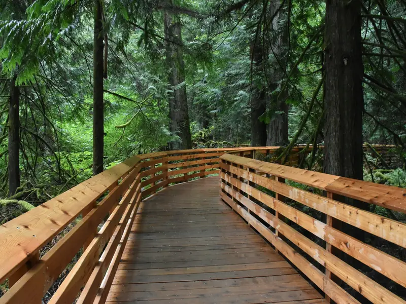
Two boardwalk loops, A and B, each 1 km, under giant western red cedars and hemlocks, with many stairs. The trailhead is on Highway 4, between Green Point Campground and Wick Road.
The parking lot is small, and RVs and buses can't use it. Trail A is across the highway, at a crosswalk with a button.
Afternoon
Long Beach and Kwisitis
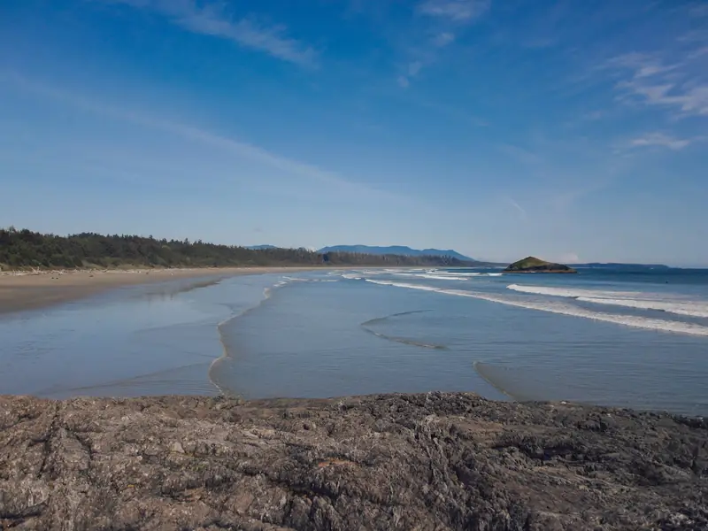
The Long Beach area has about 22 km of beaches. At the south end of Wickaninnish Beach, the Kwisitis Visitor Centre has exhibits on the land, sea and people of the coast, and a deck for watching whales, storms and surfers.
From October 27, 2026, to February 1, 2027, it's open Thursday to Monday, 9:30 am to 4:30 pm.
Late afternoon
Storm watching
From November to March the storms are at their most dramatic. Watch from a safe spot, like the deck at Kwisitis, and stay off the beach and the drift logs when the tide or the waves are high.
Check the tide table, the wave forecast and the park's wave warning sign before you go down to the beach.
Day 5 · Ucluelet and Tofino
Morning
The Lighthouse Loop, Ucluelet
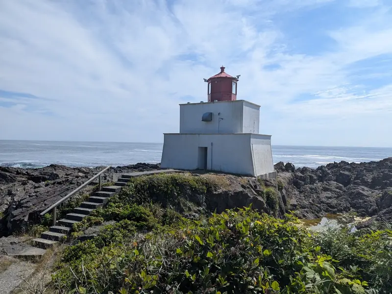
A 2.5 km loop of the Wild Pacific Trail, with views over Barkley Sound and of the Amphitrite Lighthouse. It takes 45 to 60 minutes, with benches along the way.
Parking is on Coast Guard Road.
Afternoon
The Tonquin Trail, Tofino
From the Tofino Community Hall, 3 km of gravel trail through old-growth forest to Tonquin, Third and Middle beaches, with views of Clayoquot Sound.
Or start at Tonquin Beach Road, where 800 metres of boardwalk and stairs lead down to Tonquin Beach.
Days 6 to 8 · Home the same way
About 1,205 km, about 13¾ hours of driving, and 2 hours on the ferry
Day 6
Tofino to Nanaimo
Back across the island. About 210 km, about 2¾ hours.
Day 7
The ferry, and on to Kamloops
Back to Duke Point, 2 hours on the ferry to Tsawwassen, then up the Coquihalla to Kamloops. About 375 km, about 4 hours of driving.
Day 8
Kamloops to Calgary
Back over Rogers Pass. Leave early: the clock goes forward an hour between Revelstoke and Golden. About 620 km, about 7 hours.
Fill up in Revelstoke: there's no gas at the pass.
Good to know
- If you see wildlife by the road in the mountain parks, slow down, stay in your vehicle and move on. Feeding wildlife in a national park is illegal.
- Wolves, bears and cougars live around Tofino and Ucluelet. Pacific Rim asks you to stay at least 100 metres from them, keep children close and keep food put away.
- Bringing the dog? Pacific Rim asks you to think about leaving it at home. Parts of the park are closed to dogs, and everywhere else they must be on a leash, on the beach too.
- If you feel strong shaking, or the sea suddenly pulls back, go to higher ground right away, following the tsunami route signs.
- The Long Beach area's roads and parking lots are paved, except at Kennedy Lake. The Kwisitis Visitor Centre lends all-terrain wheelchairs, pushed by a companion.
- Hours and dates on this page were checked in November 2026. They can change, so check the official websites before you go.
Going with family or friends?
Send this page to the group chat, so everyone has the drive on one map.
Plan your Tofino trip
Tell Thimble and it'll build a full itinerary for you.

Scan with your phone to get the app.
Tofino, British Columbia
Map: © OpenStreetMap contributors, Overture Maps Foundation
Checked in November 2026 on the websites of Parks Canada, the Government of British Columbia, the Government of Alberta, BC Ferries, BC Parks, the District of Tofino, the District of Ucluelet, the Town of Golden, Tourism Golden and the Revelstoke Railway Museum. Distances and speed limits are from OpenStreetMap. Drive times are worked out from them, without traffic or stops, and the ferry's time is BC Ferries' own.